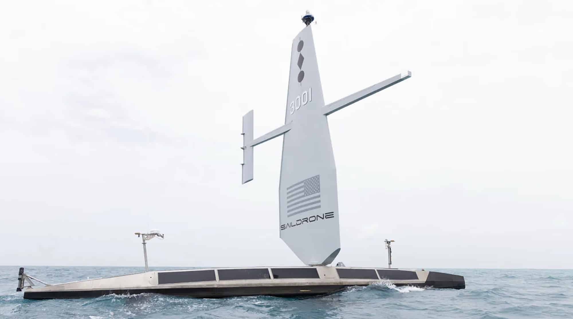
Saildrone, a leader in ocean data collection using autonomous vehicles, has launched a pioneering mission to map the Cayman Islands’ Exclusive Economic Zone (EEZ) using its unmanned surface vehicle (USV) technology.
Mapping an Area 357 Times Larger Than the Islands
The mission aims to survey 80% of the Cayman Islands’ 29,300 square nautical mile (100,530 sq km) EEZ using a 20-meter Saildrone Surveyor USV. This area is a staggering 357 times larger than the islands themselves and about half the size of Florida.
“Our waters hold such great value to us for a myriad of reasons ranging from recreational to economic,” said Premier and Minister for District Administration & Lands, Hon. Juliana O’Connor-Connolly. “Conducting this assessment will allow our government to make data-driven decisions that will strengthen our policies and legislations as it relates to our maritime infrastructure.”

Advanced Technology for Detailed Seafloor Mapping
The Saildrone Surveyor is equipped with:
- Multibeam echo sounders
- Metocean sensors
- Radar
- Cameras
- Advanced machine learning capabilities
This technology enables detailed bathymetric data collection, which will enhance:
- Maritime navigation
- Scientific research
- Environmental conservation efforts
- Marine resource management
Efficiency and Environmental Benefits
Saildrone’s approach offers significant advantages over traditional survey ships:
- Faster production: A Surveyor can be built in as little as six weeks
- Cost-effective: Fraction of the cost of a ship
- Environmentally friendly: Reduced carbon emissions
- Increased safety: Lowers risk to personnel
Brian Connon, Saildrone VP Ocean Mapping, stated, “Saildrone’s Surveyor class of USVs provides an available, economical, climate-friendly solution to mapping the world’s oceans.”

Mission Details and Local Impact
- Duration: Approximately six months
- Funding: Philanthropically supported by the London & Amsterdam TRUST Company Limited
- Data ownership: Cayman Islands government
- Chart updates: UK Hydrographic Office (UKHO) will process data for nautical chart updates
Saildrone will provide local mariners with detailed information on the Surveyor’s location when operating near popular fishing and boating areas.
DroneXL’s Take
This groundbreaking mission in the Cayman Islands showcases the immense potential of autonomous Drone Technology in ocean exploration and mapping. As we’ve seen in recent drone technology developments, the applications for unmanned vehicles continue to expand beyond traditional aerial uses.
The Saildrone Surveyor’s ability to efficiently map vast ocean areas demonstrates how drone technology can contribute to scientific research, environmental conservation, and economic development. This aligns with the growing trend of using drones for inspection and mapping in various industries, from infrastructure to natural resource management.
Photos courtesy of Saildrone
Discover more from DroneXL
Subscribe to get the latest posts sent to your email.














+ There are no comments
Add yours