


Revolutionizing Drone Technology: The Sub-$500 GPS-Free Drone
In a remarkable feat of innovation and ingenuity, a team of drone enthusiasts has successfully constructed a drone that challenges the traditional reliance on GPS satellite signals for navigation. This development, achieved during the El Segundo Defense Tech Hackathon, introduces a cost-effective solution for unmanned aerial vehicles (UAVs) to operate in environments where GPS signals are compromised or unavailable.
A Leap in Drone Navigation
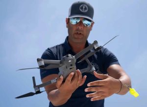
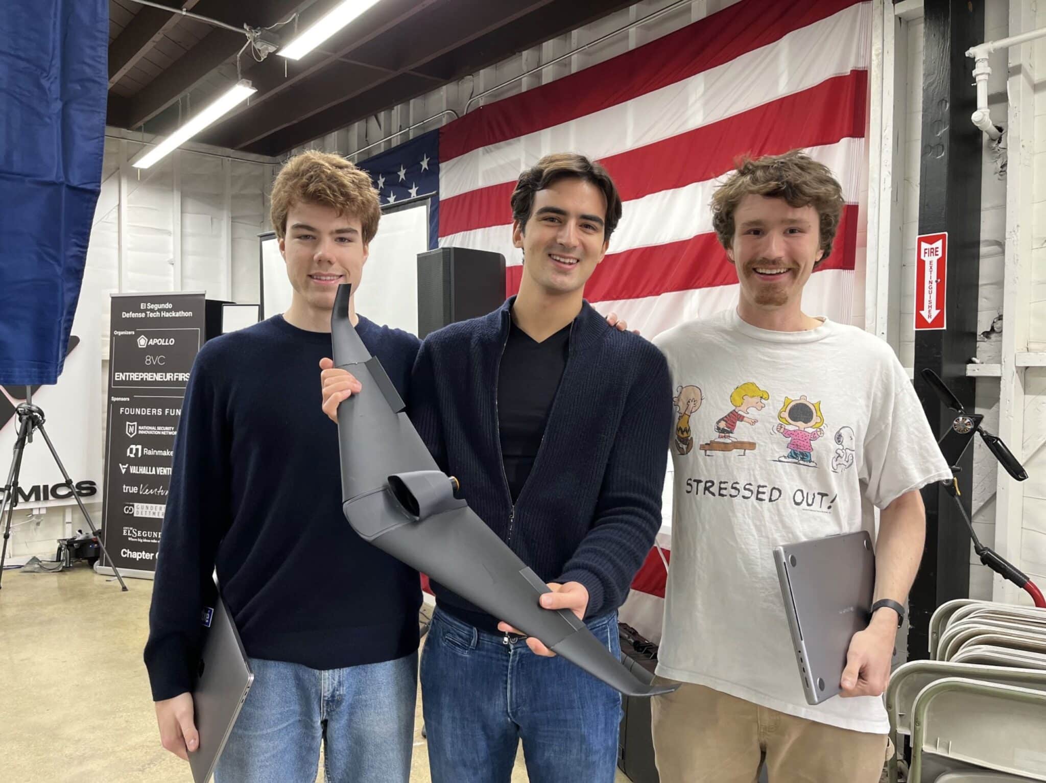
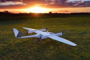
The drone, a product of 24 hours of intensive design and construction by a trio of enthusiasts, stands out for its unique navigation system. Unlike conventional drones that depend on a direct GPS satellite connection, this drone employs a camera and Google Maps to ascertain its location.

The custom-designed and 3D-printed fixed-wing drone features a large single motor and a downward-facing camera for geo-referencing, allowing it to match its surroundings with pre-downloaded segments of Google Maps to estimate its coordinates.
This technique makes use of Google Maps’ ability to let users download map segments for offline use, which is a feature that travelers and outdoor adventurers frequently use. By exploiting this functionality, the drone ensures continuous operation in GPS-denied areas, a significant advantage in remote or signal-jammed environments.
Advantages and Implications
The implications of this technology are vast, particularly for the defense industry. The ability to operate independently of GPS satellites offers a strategic advantage in scenarios where conventional navigation systems are vulnerable to disruption. The GPS-free drone can undertake missions at any time of day or night, anywhere in the world it has imagery for, without the limitations imposed by reliance on external satellite constellations.
Moreover, the cost-effectiveness of this drone is notable. Produced for under $500, and potentially even less at scale, it represents a significant reduction in the expense typically associated with advanced Drone Technology. This affordability, combined with its innovative navigation solution, marks a significant step forward in making sophisticated UAV capabilities accessible to a broader range of users and applications.

Birth at the El Segundo Defense Tech Hackathon
The inception of this groundbreaking drone occurred at the El Segundo Defense Tech Hackathon, an event hosted by 8VC, Entrepreneur First, and Apollo Defense in collaboration with the U.S. Department of Defense and the National Security Innovation Network (NSIN). The hackathon focused on challenges related to counter-UAS technologies, Artificial Intelligence/machine learning (AI/ML), and RF/Electronic Warfare, providing fertile ground for innovative solutions like this drone.
As reported by Ian Laffey, a member of the team, on social media, the project involved designing, 3D printing, and building a drone capable of calculating GPS coordinates without a signal, using a camera and Google Maps—all within a 24-hour period. This achievement not only demonstrates the potential for rapid development and deployment of new technologies but also highlights the collaborative spirit and technical prowess of the participants.
A Step Towards Autonomous Future
The creation of a sub-$500 GPS-free drone represents a significant leap forward in drone technology, offering a new level of autonomy and resilience in UAV navigation. By eliminating the dependence on GPS satellite signals, this innovation opens up new possibilities for drone operations in challenging environments, with broad implications for both civilian and military applications. As this technology evolves, it promises to enhance the capabilities of drones, making them more versatile, accessible, and effective tools for a wide range of tasks.
Hat tip to DroneNR. Photos courtesy of Ian Laffey and the team.


+ There are no comments
Add yours