
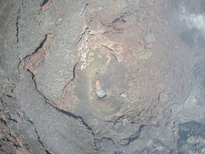


USGS Hawaiian Volcano Observatory geologists have captured remarkable close-up imagery of an active lava pond within Kīlauea’s summit crater using advanced Dji Drone Technology, providing unprecedented scientific documentation of the volcano’s ongoing eruptive activity.
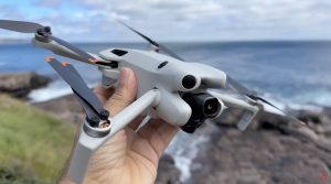
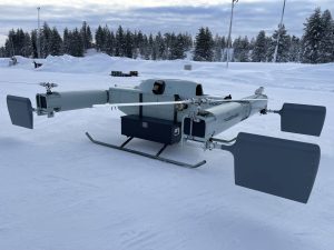
During uncrewed aircraft systems overflights on May 21, USGS Hawaiian Volcano Observatory geologists flew their DJI Matrice 600 drone equipped with an XT2 thermal camera directly above the south vent within Halemaʻumaʻu at Kīlauea’s summit.
The drone mission documented fascinating gas pistoning cycles within the vent, as scientists observed a lava pond gradually rising over the course of an hour before rapidly dropping within tens of seconds as volcanic gas was expelled.

Dji Zenmuse XT2 made this possible
The breathtaking images of the lava pond were taken at nearly peak elevation, and the molten framework was estimated to be between 15-30 ft (5–10 meters) in diameter. The thermal imaging capabilities of the XT2 camera system provided critical temperature data and visual documentation impossible to collect through standard ground observations.

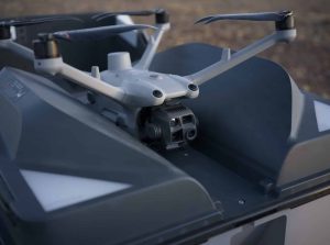
The Matrice 600 combined with the XT2 camera were the combination used to get those images
Drone flights detected action at both Halemaʻumaʻu’s eruptive vents. Geologists mentioned the north vent occasionally spattering and always incandescently fuming, and both vents displaying continuous degassing activity with occasional spattering of new lava from incandescent vents at their bases. The shape of the north vent, a rounded pit of similar size, exhibited what scientists described as a “wasp nest” appearance with its nested shape on top of existing features and a coarse texture of its surface.
The platforms that USGS uses
This observing mission comes after the conclusion of Episode 22 on May 16, which had approximately 10 hours of lava fountaining activity. Since then, scientists have observed sustained inflationary tilt patterns, and this indicates that another episode of eruption remains likely in the near future.

The DJI Matrice 600 platform represents a significant advancement in volcanic monitoring capabilities. This heavy-lift hexacopter drone provides the stability and payload capacity necessary to carry sophisticated thermal imaging equipment like the XT2 camera into the extreme conditions above active volcanic vents. The combination enables scientists to conduct detailed observations while maintaining safe distances from hazardous volcanic activity.

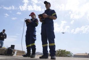
These specialized drone operations always require authorization from Hawaiʻi Volcanoes National Park, as unauthorized UAS operations within National Park Service lands and waters are prohibited under federal regulations. The USGS Hawaiian Volcano Observatory conducts these flights as part of their essential mission to monitor active Hawaiian volcanoes, assess volcanic hazards, issue public warnings, and advance scientific understanding to reduce eruption impacts on local communities.
Photos Courtesy of USGS, by M. Zoeller.
Discover more from DroneXL.co
Subscribe to get the latest posts sent to your email.


+ There are no comments
Add yours