


Weekly UAS News Update
Welcome to the Weekly UAS News Update. We have four drone news stories for you this week:
- Another proposed bill that would attack the industry
- Commercial UAV Expo workshops
- Wingtra Cloud, a new software
- Two new courses from Pilot Institute
Let’s get to it.

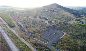
Proposed Bill Attacking the Drone Industry
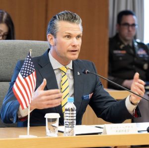
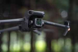
It is time again to make your voices heard, and now this time in the U.S. Senate. The Senate Armed Services Committee is considering its own version of the National Defense Authorization Act (NDAA). The House version of the NDAA includes the Countering CCP Drone Act, which would ban DJI drones. It’s very important at this stage that neither the Drone for First Responders Act (which we’ve been talking way too much about) nor the Countering CCP Drone Act is included in the bill language from the Senate version.
As a reminder, the Countering CCP Drone Act plans to ban DJI drones by revoking or preventing new FCC approval for Chinese drones, which would affect everyone, including public safety agencies. The DFR Act would ban Chinese drones in five years after creating an incremental tariff, which would affect everyone, including public safety agencies that would lose financial aid after 5 years and have to pay for expensive drones without any kind of subsidies.
The Senate is scheduled to be voting on this version of the Act next week, between June 11 and June 13, so it is very timely that you act now. Please visit the DAA (Drone Advocacy Alliance) website to make sure that you contact your senator. You’ll find links there to find the closest person to you. Please, please, please take action if you disagree with this. This is extremely important. This industry is under attack from several fronts now, and we need to make our voices heard.
READ MORE: DRONE INDUSTRY’S OUTRAGE OVER STEFANIK’S ANTI-CHINA LEGISLATION
Commercial UAV Expo Workshops
Next up is the Commercial UAV Expo, which is somewhat around the corner. We got confirmation this week that we were approved for a new panel. “We” meaning a few people from the industry: Dezire Xin, Jared Yannick who teaches our course for mapping, Vic Moss (you know Vic), Kenji Sugahara (you probably know Kenji as well), and Amy Wig. We will be discussing regulation and compliance, talking about BVLOS (Beyond Visual Line of Sight), airspace management, Remote ID, operations over people and moving vehicles, and plenty more. The talk is scheduled for Tuesday, September 3rd, from 1:00 p.m. to 3:30 p.m. at Caesar’s Palace in Las Vegas.
If you plan to attend the conference, please be sure to join us. And if you don’t plan to attend, this might be a good reason to do so. We’ll have links in the next couple of weeks to get tickets. This is one of the largest expos out there for drones, and actually, I think this is my favorite because there are a lot of people that fly drones that go to this conference, unlike some other conferences we’ve been to in the past that are mostly attended by people in suits, which doesn’t appeal nearly as much to what we do.
READ MORE: STEFANIK’S ANTI-CHINA AND ANTI-DJI DRONE BILL SPARKS CONTROVERSY
Wingtra Cloud Software
Wingtra released a new software called Wingtra Cloud this week. It’s a software solution for flight planning, site-based file organization, 3D planning, and coordinate systems. The primary goal of the new software is to streamline surveyor workflow and enable more data capture. It doesn’t look like at this stage Wingtra Cloud integrates with image processing, but integrations are available according to Wingtra’s website. We’ll keep you updated if we see more, but this is pretty exciting.
New Courses from Pilot Institute
For the last story this week, we have two brand new courses. The first one is a LiDAR course. This is the fourth and I think final volume of our mapping series. We created three courses last year to help you get started with mapping and building more and more complex maps over time. This course obviously uses Lidar technology to add on to the knowledge that you’ve learned from the other courses. It is available now on our website. Please go ahead and visit pilotinstitute.com.
The second course that we are releasing is a course on Search and Rescue, which we recorded with our good friend Kyle Nordfors from the Weber County Search and Rescue. We actually went to Utah a couple of weeks ago to finish recording this course. There’s a ton of information in there about how to search for someone. If you’re interested in doing this, obviously you will have to work with an agency to do so, but Cal shares a ton of knowledge on how he flies in the mountains of Utah, which is a very challenging environment. He’s able to tell you and show you exactly how you’re supposed to be looking for people, talking about lost person behavior, and a lot of other things. There’s also a very cool video at the very end where we did a kind of reconstruction of somebody getting lost, and we show you exactly how it works, step by step. I’m really proud of the team for working on this and getting these courses out to you guys. Again, check out pilotinstitute.com if you want more information.
Wrap-up
That’s it! We’ll see you next week. We’ll see you on Monday for the live session, and otherwise, Friday morning for the news update.
Discover more from DroneXL
Subscribe to get the latest posts to your email.


+ There are no comments
Add yours