


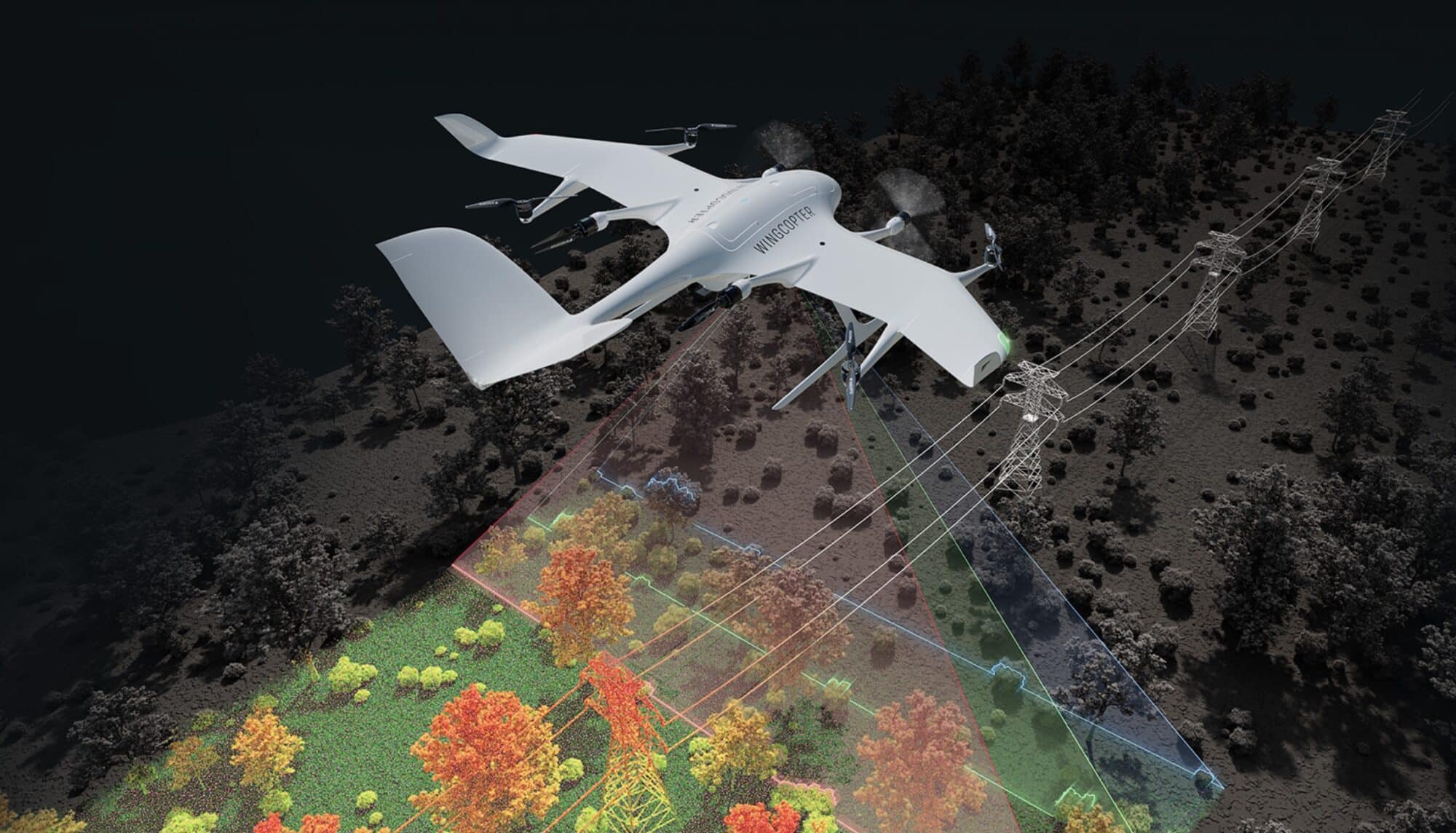
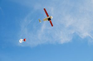
Wingcopter, the German drone manufacturer behind the FAA certification-pending Wingcopter 198, announced its expansion into long-range LiDAR surveying solutions at Geo Week 2025 in Denver, Colorado. The company’s proven EVTOL platform will now carry advanced laser scanning systems designed for power line, pipeline, railway, and road inspection, as well as mapping terrain and vegetation in difficult-to-access areas.
The enhanced Wingcopter 198 can survey up to 37 miles of linear infrastructure in a single beyond visual line of sight (BVLOS) mission while carrying a 10-pound sensor payload. According to Wingcopter, the system achieves point cloud densities up to 570 points per square meter with 10mm sensor accuracy and 5mm precision. In a 42-minute BVLOS flight, the drone can scan approximately 2,560 acres.
“After years of developing and relentless testing, we have frozen the Wingcopter 198 in the configuration that is currently undergoing FAA type certification in the United States. The drone has unique payload and range characteristics, and with a proven product lifetime of more than 1,000 flight hours, it is one of the most reliable long-range eVTOL UAS on the market,” explains Ansgar Kadura, Co-Founder and Chief Strategy Officer at Wingcopter. “Based on this configuration, we are developing a solution to address the field of high-quality LiDAR surveying and integrating the best commercially available sensor systems. I look forward to discussing with surveyors and learning about their vision for an ideal BVLOS LiDAR surveying drone.”
The Wingcopter 198 Proven Success
The Wingcopter 198 has achieved a proven product lifetime of over 1,000 flight hours in its current configuration, which is undergoing FAA type certification in the United States. The company’s Brazilian partner Synerjet plans to deploy the surveying variant with a high-end LiDAR sensor featuring a 100-degree field of view and 2.4 MHz pulse repetition rate. The sensor’s tri-directional scanning pattern – nadir, +10 degrees forward, and -10 degrees backward – enables comprehensive data capture of vertical surfaces, narrow canyons, transmission lines, railways, highways, and forest plantations.

This expansion marks Wingcopter’s strategic move beyond cargo drone operations into infrastructure inspection and surveying applications. The Wingcopter 198’s payload capacity allows it to carry high-end sensor systems weighing up to 10 pounds, while its range enables coverage of extensive linear infrastructure in single flights.
The announcement comes as the company confirms it has frozen the Wingcopter 198’s configuration for FAA type certification. While specific pricing details weren’t disclosed, the platform’s ability to survey up to 2,560 acres in a single 42-minute mission demonstrates its potential for efficient large-scale data collection.
In Brazil, Synerjet is developing custom applications for the platform, focusing on asset inspections, vegetation monitoring, and mapping. Their implementation of the high-end LiDAR system aims to provide comprehensive data capture capabilities, particularly in challenging environments with complex vertical surfaces and varied terrain.
Photos courtesy of Wingcopter
Discover more from DroneXL.co
Subscribe to get the latest posts sent to your email.


+ There are no comments
Add yours