

Innovative Use of Drones in Reptile Conservation
Forget Walmart drone deliveries; the latest use for drones might surprise you. Researchers are using drones to map the temperatures at which lizards thrive, a technique that could revolutionize our understanding of reptile conservation amid climate change.
The Challenge for Cold-Blooded Creatures
Cold-blooded animals, like lizards, rely on specific temperature ranges for survival. As human activities, such as deforestation, and climate change alter their habitats, it becomes critical to analyze the heat conditions these creatures live in. The Bay Islands anole (Anolis bicaorum), a critically endangered species found only on the island of Utila, Honduras, faces significant threats from habitat loss due to urbanization.
Traditional vs. Drone-Based Methods
Traditional methods to measure a lizard’s thermal environment involve using 3D-printed lizard replicas equipped with thermometers. However, these replicas are expensive, limiting the number of data points and making it difficult to assess thermal suitability across entire landscapes.
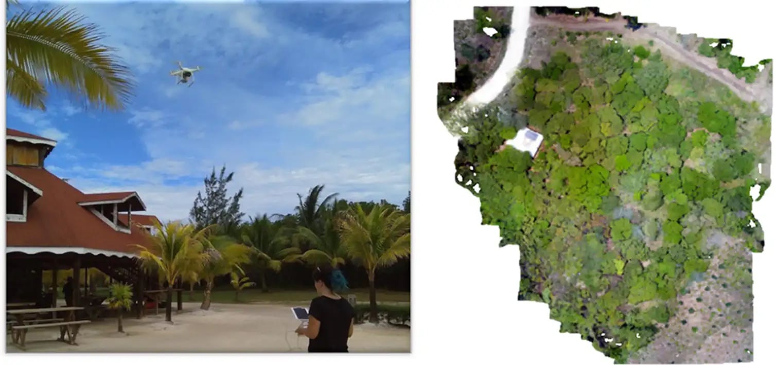
How Drones Are Transforming Data Collection
Researchers have turned to drones to gather detailed canopy metrics over large study areas. By hovering drones a few meters above the plots and capturing high-resolution images, they extracted data on canopy cover and structure. Combining this drone data with ground-based temperature measurements and machine learning models, they successfully predicted the temperatures that A. bicaorum lizards would experience at solar noon.
The Importance of High-Resolution Thermal Maps
This drone-based approach allows the creation of continuous, high-resolution temperature maps across entire landscapes, providing far more relevant data for conservation planning than traditional methods. These detailed maps are crucial for understanding the impacts of climate change and habitat loss on cold-blooded species.
Next Steps in Research
The next phase involves testing this method across different species and habitats and incorporating 3D data to map thermal variations throughout the day. This comprehensive approach will enhance our understanding of how species like the A. bicaorum lizard use their thermal environments.
DroneXL’s Take
Drones are proving to be invaluable tools in Wildlife conservation. This innovative use highlights their potential to gather critical data efficiently and accurately, aiding in the fight against the dual threats of climate change and habitat loss. As technology advances, drones will likely play an even more significant role in preserving our planet’s biodiversity.
For more detailed insights, you can read the full article here.
Discover more from DroneXL
Subscribe to get the latest posts to your email.


+ There are no comments
Add yours