


Roark Aerospace, a counter-drone and drone services Specialist operating in the UK and US, has announced two significant developments: the over-the-counter availability of its advanced drone detection systems and an expansion of its aerial mapping services across multiple cities.
Advanced Detection Systems Now Available OTC
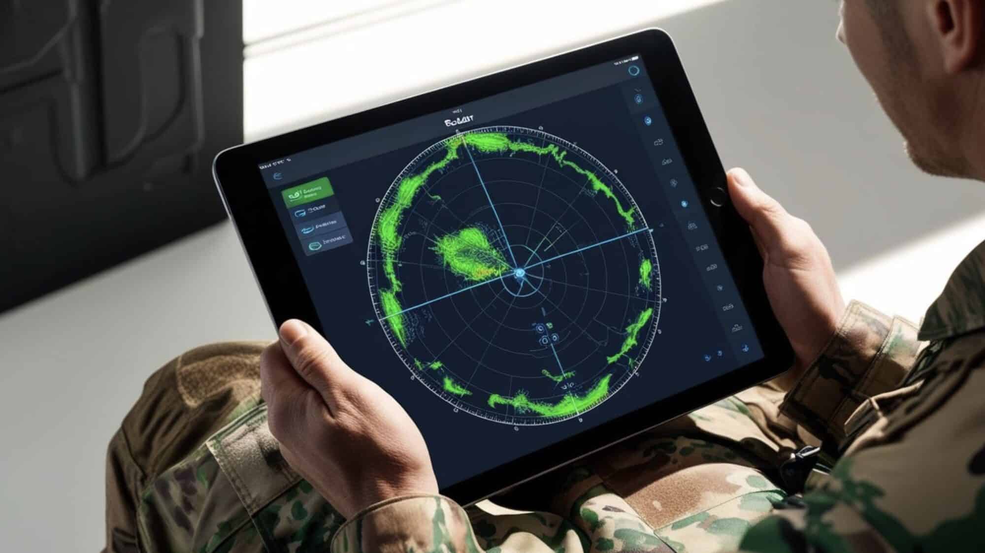
The company’s drone detection portfolio now includes two distinct systems. The standard Aero-Ark system provides comprehensive detection capabilities, including ADS-B monitoring, Remote ID compliance, DJI packet collection and decryption, and passive radar functionality. For urban environments, where traditional radar systems face challenges from radar shadows, Roark has developed a specialized variant utilizing programmable meta surfaces (PMS) and conical horn transceiver units.
These systems, starting at £4,500 ($5,715) excluding taxes, can be deployed individually or as co-units in both portable and sentry configurations. Each unit features on-device (edge) AI processing and classification powered by Roark’s large language models.

Real-Time Mapping Network
Roark is expanding its Wide Area Motion Imagery (WAMI) and Hyperspectral Imaging (HSI) services, which now cover 30 cities in the United States and 12 in the United Kingdom. This service utilizes purpose-built drones and cameras to enhance the ground information available through the company’s Plexus platform.
Pilot Engagement Program
To support the expansion of its mapping network, Roark is offering several incentives to hobbyist and commercial drone pilots, including:
- Financial sponsorship for RPAS qualifications, including Part 107 certification
- Free WAMI/HSI cameras for attachment to third-party drones
- Access to the Plexus data platform
Integrated Platform Access
All detection systems include access to Roark’s Plexus data platform, which integrates both airspace and ground-level monitoring in real-time. The platform combines drone detection capabilities with the company’s expanding WAMI and HSI mapping network to provide comprehensive surveillance capabilities.
This combination of over-the-counter detection systems and expanding urban mapping coverage represents a significant development in accessible drone monitoring and surveillance technology. The initiative to incorporate civilian drone operators into the mapping network suggests a collaborative approach to expanding aerial surveillance capabilities.
Discover more from DroneXL.co
Subscribe to get the latest posts sent to your email.


+ There are no comments
Add yours